This time i was able to join the team on Hirtstein in JO60OM. It was planned to do CW Fieldday and Microwave 23 + 13cm. For 23cm we took the rig of Henrik, DG0LFF. For 13cm new masthead transverter with 75W PA was just finished. In the last moment i took the 1m mesh dish with me as well as my old 9cm transverter with 5W PA and a patch antenna as well as my 6cm transverter on tripod. Fred, DH5FS brought the 10GHz station. I also took my laser station for some try with DM1LGF and DL3ARM.
We mounted two mast. One with 2x20ele for 23cm on top and the 1m dish with the transverter below. Only some meters above ground and to be turned by hand we mounted the patch for 9cm and the transverter. The 6cm transverter did stay on the tripod on ground level. 3cm was located on the second mast.
23cm was pretty good and also the new 13cm rig did a good job without any issues. Even on 9cm quite some QSO were done and even on 6cm there was some success although the time for those trials was limited.
Saturday evening i tried to establish lightwave contact with DM1LGF and DL3ARM. Unfortunately the sight was very bad (a lot of dust) and it was not possible to see the horizon. Therefore the 2 attempts did fail for this time although we spent a lot of time to find the correct direction.
Results:
23cm 71QSO 17000p
13cm 29QSO 6900p
9cm 8QSO 980p
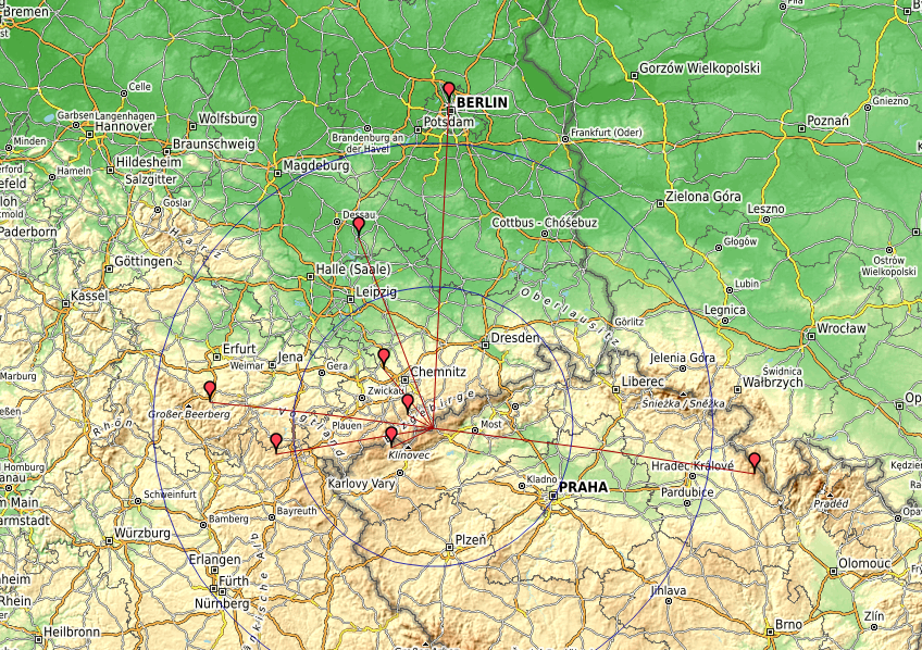
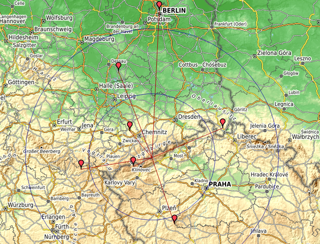
6cm 5QSO 480p
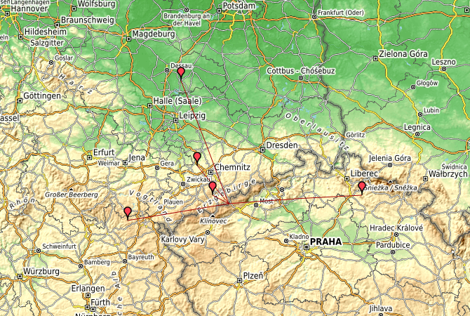
3cm 7QSO 800p
Some impressions:
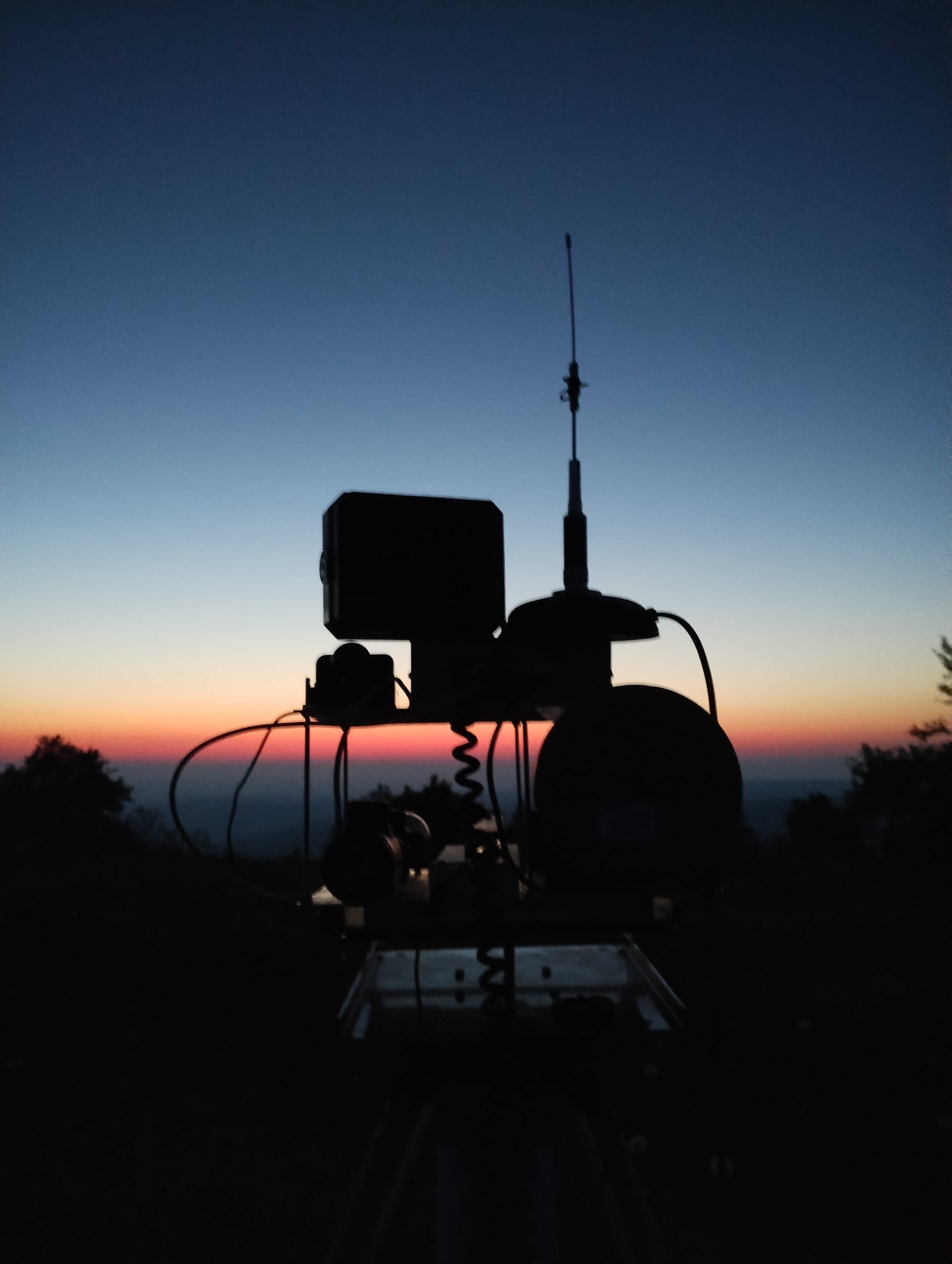
laser station at sunset
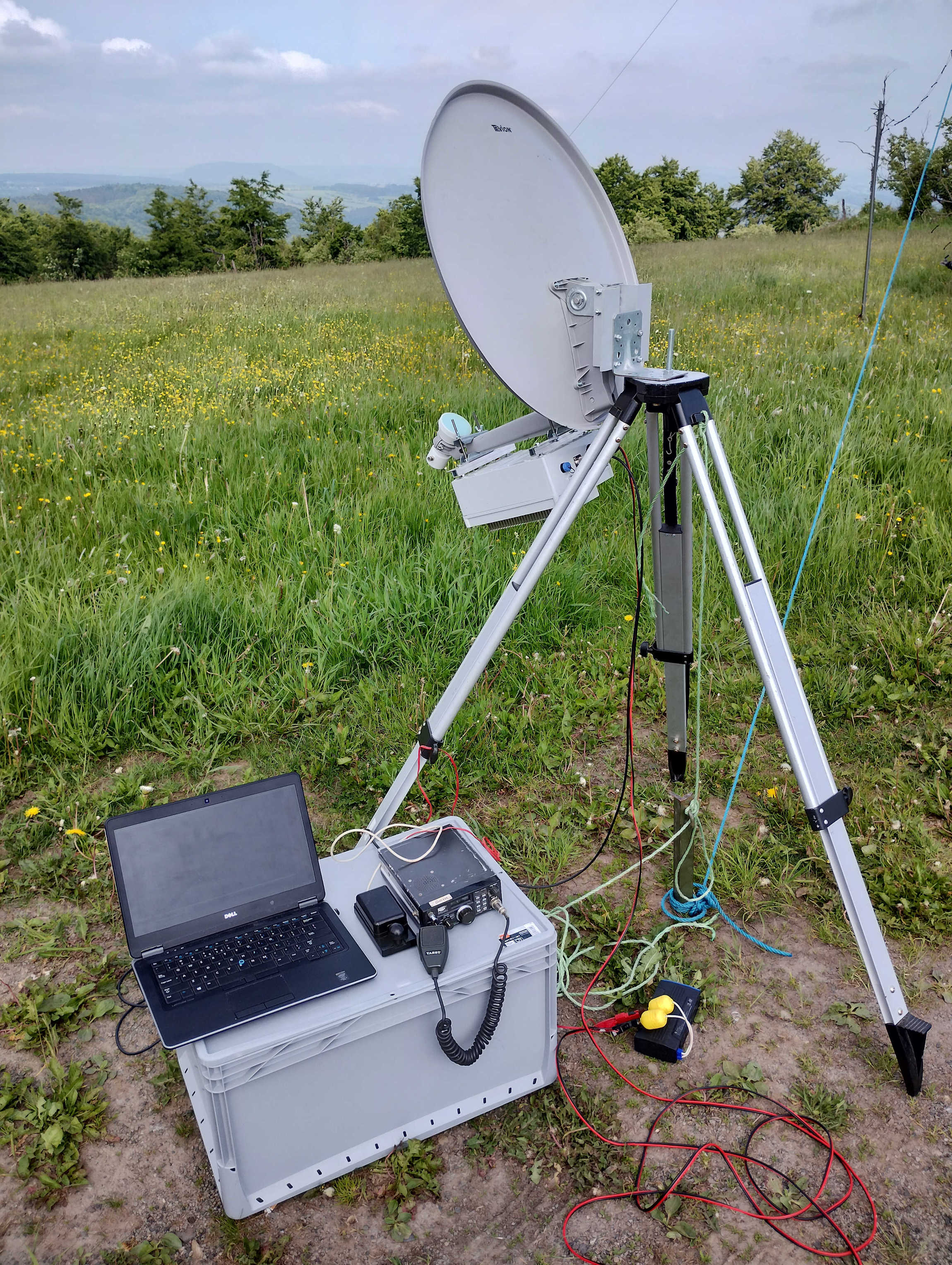
6cm tripod station
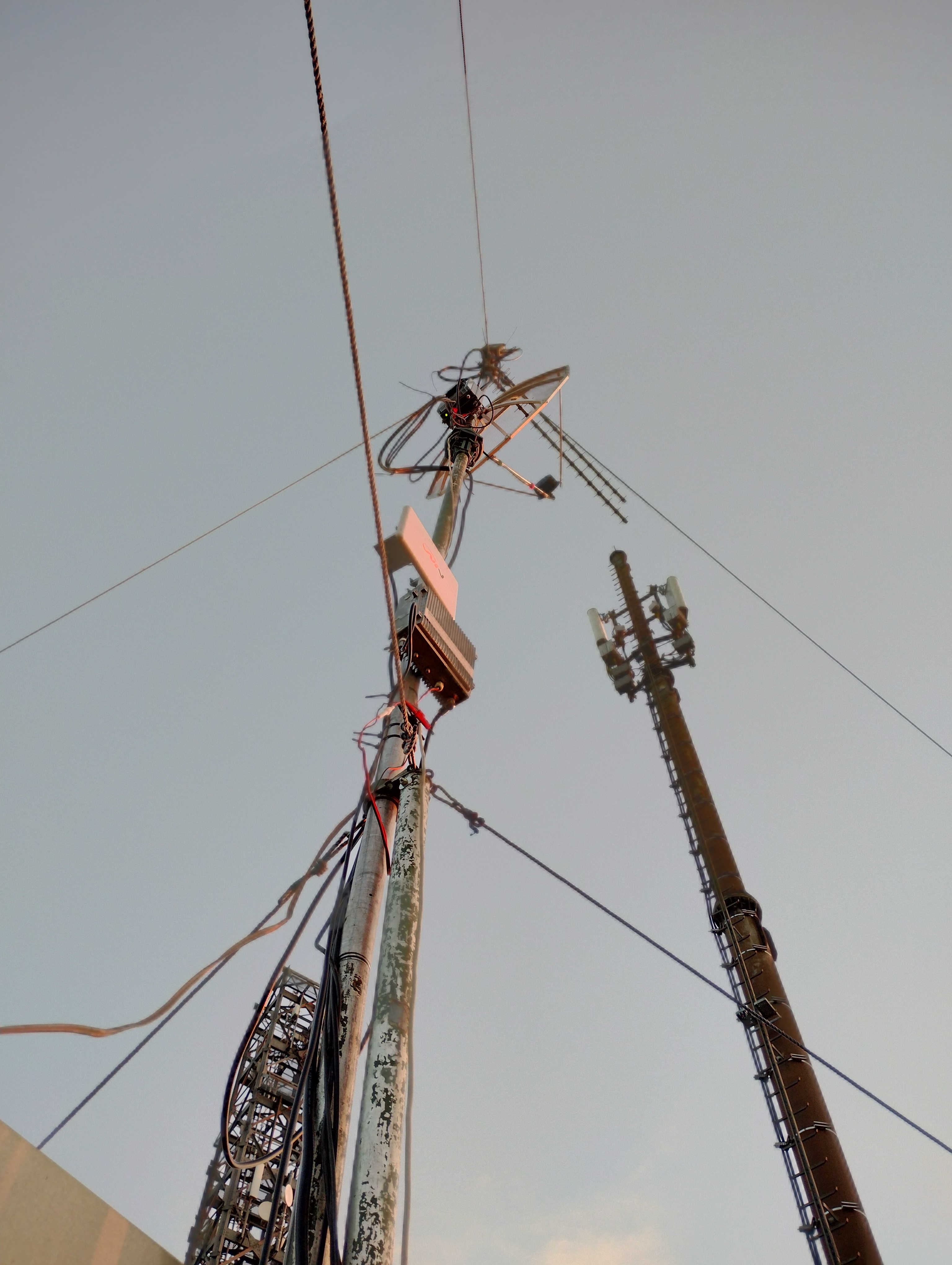
23cm/13cm/9cm
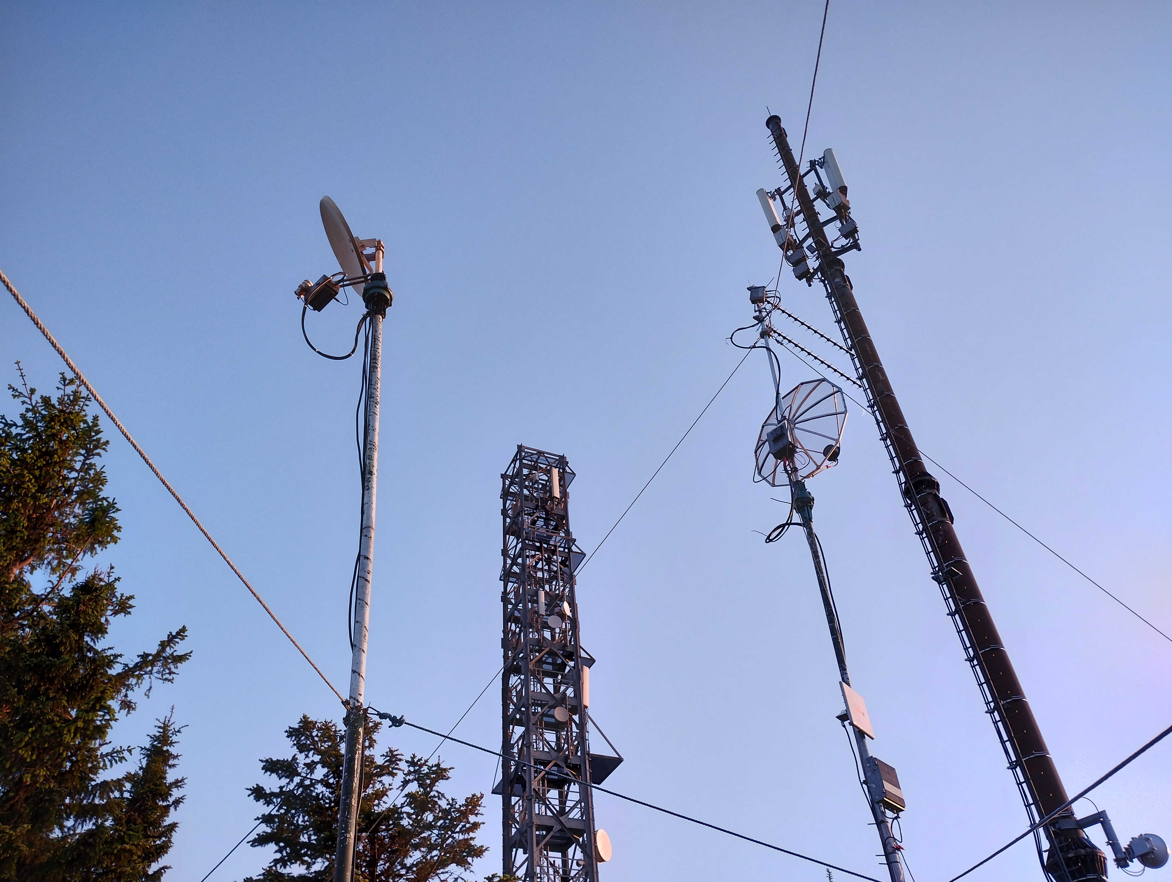
microwave antennas june 22
QSO maps:
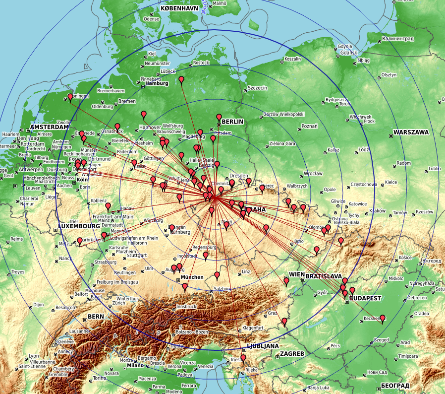
23cm 22/06 – Kartendaten: OpenStreetMap-Mitwirkende, SRTM | Kartendarstellung: OpenTopoMap (CC-BY-SA), DL4MFM log analyzer
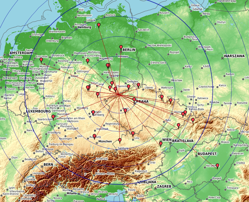
13cm 22/06 – Kartendaten: OpenStreetMap-Mitwirkende, SRTM | Kartendarstellung: OpenTopoMap (CC-BY-SA), DL4MFM log analyzer
9cm 22/06 – Kartendaten: OpenStreetMap-Mitwirkende, SRTM | Kartendarstellung: OpenTopoMap (CC-BY-SA), DL4MFM log analyzer
6cm 22/06 – Kartendaten: OpenStreetMap-Mitwirkende, SRTM | Kartendarstellung: OpenTopoMap (CC-BY-SA), DL4MFM log analyzer
3cm 22/06 – Kartendaten: OpenStreetMap-Mitwirkende, SRTM | Kartendarstellung: OpenTopoMap (CC-BY-SA), DL4MFM log analyzer